BUILDING INFORMATION MODELLING (BIM)
BIM 3D WORKFLOW AND ITS ADDED VALUE
Landscape architecture design and construction has moved into the digital realm, allowing coordination with multidisciplinary BIM models, thus providing an additional layer of information rich output. Gustafson Porter + Bowman can deliver projects to BIM Level 2 which improves our integration with documentation and processes to effect substantial improvements in practice.
BIM allows our 3D landscape design approach to be an integral part of a project, generating a consistent review and coordination method with other disciplines. We have recognised its value and progressively champion the use of key 3D design and project management tools in our workflows to deliver fully integrated landscapes.
We have worked directly with the software developers to address landscape requirements and ensure it is supported by the wider AEC industry needs. By creating accurate modelling, validation, coordination and clash detection, client, design team and contractor can benefit from the effectiveness of these processes, saving on money and time.
BIM ENABLE US TO:
Increase the efficiency of our workflows and streamline our internal procedures, extracting accurate and multi-disciplinary data to make informed decisions and save on costly errors.
Coordinate and communicate effectively with other disciplines and consultants.
Increase our quality assurance and ensure high-quality external landscapes, where risk management helps to reduce cost and improve safety.
Undertake detailed environmental analysis and understand sites better to create innovative sustainable design outcomes.
Reliably control the management of project scopes, timescales and budget.
Manage milestones and expectations, providing comprehensible model information updates to our client and team.
BIM SERVICES
Our scope of services includes:
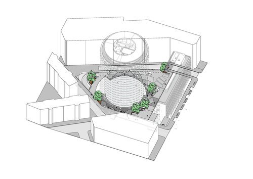
2D, 3D, 4D and 5D Revit information modelling provided by trained staff and the use of other 3d platforms to generate visualisations that can help clients to assess their aspirations and vision.
Common Data Environment (CDE) in place via BIM360 to carry on the Information Management of a project and ensure procedures, exchange of information and documentation are consistently organised and with easy access to any party involved.
Clash detection to identify coordination and spatial issues with other consultant’s design models at each design stage of the project, reporting findings and providing clash resolution.
Environment Analysis as a design tool that can be tested with the input and expertise of other competent professionals to make informed decisions beneficial for the project.
Provide a consistent geo-referenced base and coordinates data on our models, making it easier to locate landscape features and their setting out, e.g. street signage, furniture and trees, including their associated meta-data.
